Info Tech Enterprises
Thursday 24 May 2018
Saturday 17 February 2018
Cadastral GIS of Real Value
InfoTech’s
Cadastral Mapping GIS applications, while not as glamorous as GIS applications for
emergency response or law enforcement, enhance the performance of the
assessor's office and often provide the foundation for the development of GIS
throughout a local government.
Cadastral
data defines the geographic extent of the past, current, and future rights and
interests in real property and the spatial information needed to describe that
geographic extent. These rights and interests are contained in land record
documents.
The Cadastral data for a county, known as the tax assessment role, is maintained by
the county assessor's office. Assessors do not determine tax rates, nor do they
collect or figure taxes-they value real property for taxation purposes. This
ensures the equitable distribution of a community's tax burden.
Property
taxes are the major source of revenue that allows local governments to provide
community services such as fire and police protection. The quality of the work
performed by this office directly impacts the financial security of a
community.
Tax maps
were originally drawn by hand on Mylar or linen. These maps were difficult to
keep up-to-date and cumbersome to store and retrieve. Multiple copies of maps
sometimes contained different or conflicting information. Tax maps maintained
as part of a GIS are more easily updated, organized, and shared across
departments in a local government. Parcels can be linked to data stored in a
Computer Assisted Mass Appraisal (CAMA) system, a widely used system for
storing tabular information on real property.
Working Better and Smarter
GIS also
benefits assessors by improving the quality of valuations. More factors
relating to each property can be considered when determining value. Instead of
hunting through paper maps or searching CAD documents, an assessor can query
and not only find the parcel immediately but also access related information
that previously was kept in separate tabular databases or in filing cabinets.
Square footage and acreage calculations can be performed on the fly.
"Location,
location, location," the mantra of real estate agents, holds true for
assessors as well. Knowing the location of the subject property in relation to
factors such as flood zones or water frontage improves valuation. By querying
the GIS, assessors can identify all properties with similar use codes, sizes,
locations, or other features that affect value in a specified area.
GIS is
also a tool for working smarter. Thematic mapping makes it easy to spot such
things as disparities between selling prices and assessed values or missed
assessments. Land and building values can also be analyzed by neighborhood to
help identify areas of concern. Homogeneous areas can be identified so that
mass appraisal techniques can be used to streamline work.
Working
smarter extends to the management aspects of running an assessor's office. GIS
can help manage personnel and chart work flow.
Blog Source: www.infotechenterprises.net
Tuesday 26 December 2017
Outsource MEP Services in India
MEP Drafting Services is used for creation of detailed co-ordination drawings of various systems there by providing an effective synchronization between all the individual building designs. MEP refers to Mechanical, Electrical and Plumbing systems that are being implemented in a wide range of residential, commercial and industrial buildings.
Infotech Enterprises offer MEP Outsourcing Services in India to cater to this very need. We specialize in Mechanical, Electrical, and Plumbing, Services which enables us to offer solutions to pre-construction planning and design validation to architectural construction and engineering organizations.
Team members in Infotech Enterprises who are working for MEP Drafting keeps a deep knowledge of Mechanical, Electrical, and Plumbing. These members are capable of delivering the project at 100% accuracy rate.
Our services are aligned with design processes right from concept, design to installation phases and directed towards helping clients meet their project goals efficiently. A design that promotes clash free installation and high sustainability lies at the core of our services.
Monday 11 December 2017
CAD Outsourcing Services in India
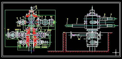
CAD Conversion Services is a technique of converting paper drawings to CAD data. This become most effective way of handling, storing and maintaining information in an organized manner, Handing paper drawings are annoying with the possibilities of damaging or losing them.
Infotech Enterprises is Leading outsourcing service provider located in New Delhi, India. With the state-of-art facility and skilled in-house staff we support customers across the globe with different industry vertical including Engineering and Manufacturing.
 We provides Paper to CAD Conversion for architects, contractors, engineers and other industry professionals and has the competence to process Scanned Drawing/PDF/tiff file to CAD Conversion needs timely.
Infotech Enterprises offer CAD Drafting Services Outsourcing to cater to this very need. We specialize in Drafting CAD, CAD conversion Services which enables us to offer solutions to pre-construction planning and design validation to architectural construction and engineering organizations.
Wednesday 6 December 2017
Transmission Line Management Using LiDAR and PLS-CADD
InfoTech is having trained resources working on and generating models for various client requirement. InfoTech’s resources are well trained in both the traditional LiDAR techniques as well as PLS-CADD, the recent in the industry. The use of PLS-CADD has made the post processing of LiDAR data quite easy and much more effective. The needs of an electrical domain client is well understood by InfoTech and accordingly processed using the latest industry standard tools: PLS-CADD.
A key factor in maintaining an electrical company's high system reliability is the timely and accurate management of its various transmission assets. The use of PLS-CADD with aerial LiDAR data is a key tool in managing these assets. Accurate PLS-CADD models are developed using aerial LiDAR survey. Usually here data is obtained for a specific width of corridor along the complete circuit (in miles) of the transmission system. Using these models, real time situations and problems involving the transmission system can be simulated, studied and resolved in the office at a fraction of the time and costs when compared to previous traditional techniques used in the field. Now the developed PLS-CADD models helps in finding faulty situations and the same were examined and resolved timely. This technique is quite accurate and fast as compared to the traditional techniques being used. The continued integration of the LiDAR based PLS-CADD models into Electrical asset management system will provide additional benefits in the areas of Vegetation Management, Construction and Maintenance, System Operations and Engineering.
Sunday 3 December 2017
MEP Drafting Services Outsourcing from India
MEP Drafting Services is used for creation of detailed coordination drawings of various systems there by providing an effective synchronization between all the individual building designs. MEP refers to Mechanical, Electrical and Plumbing systems that are being implemented in a wide range of residential, commercial and industrial buildings.
Infotech Enterprises offer MEP Outsourcing Services in India to cater to this very need. We specialize in Mechanical, Electrical, and Plumbing, Services which enables us to offer solutions to pre-construction planning and design validation to architectural construction and engineering organizations.
Our services are aligned with design processes right from concept, design to installation phases and directed towards helping clients meet their project goals efficiently. A design that promotes clash free installation and high sustainability lies at the core of our services.
Team members in Infotech Enterprises who are working for MEP Drafting keeps a deep knowledge of Mechanical, Electrical, and Plumbing. These members are capable of delivering the project at 100% accuracy rate.
Saturday 18 November 2017
Outsource CAD Conversion Services
CAD Conversion Services is a stage that is used to convert maps, sketches, schematic diagram, or circuit diagrams where the positional accuracy of the objects is important.
CAD Conversion is a technique of scanning of paper drawings and digitizing them. This becomes the most effective way of handling, storing and maintaining information in an organized manner. handling paper drawings are tedious with the possibilities of damaging or losing them.
 Infotech Enterprises offers end to end CAD Conversion, Paper to CAD Conversion with an attention to perfect accuracy and best quality. Our team comprises of Engineers, Architects, and Draftsmen who have rich experience across various industry verticals and are familiar with codes of practice globally.
Infotech Enterprises offer CAD Drafting Services Outsourcing to cater to this very need. We specialize in Drafting CAD, CAD conversion Services which enables us to offer solutions to pre-construction planning and design validation to architectural construction and engineering organizations.
Subscribe to:
Posts (Atom)


